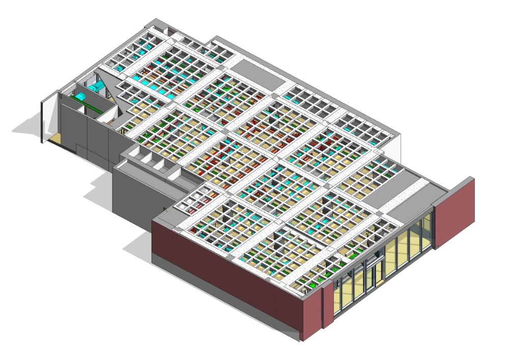
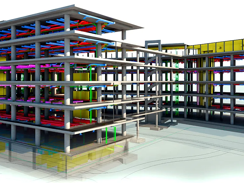
For this project, our team was commissioned to carry out a detailed measured building survey of the ground floor to support the client’s design coordination requirements. The primary objective was to create an accurate 3D model that combined architectural, structural, and MEP information, with particular emphasis on capturing precise structural and MEP details for further design development.
Equipment Used
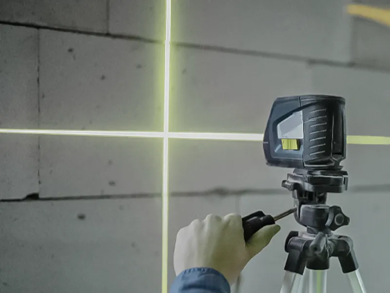
Laser Scanner RTC360
Leica GNSS Receiver GS14
Leica Total Station TS16
Duration
Site time: 3 days
Modelling time: 45 days
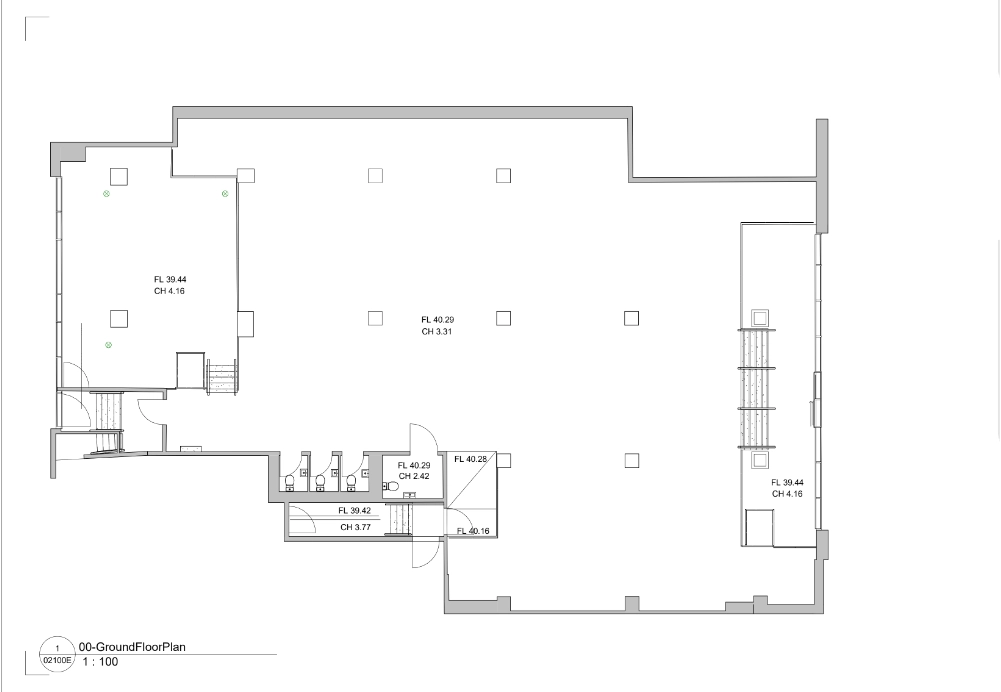
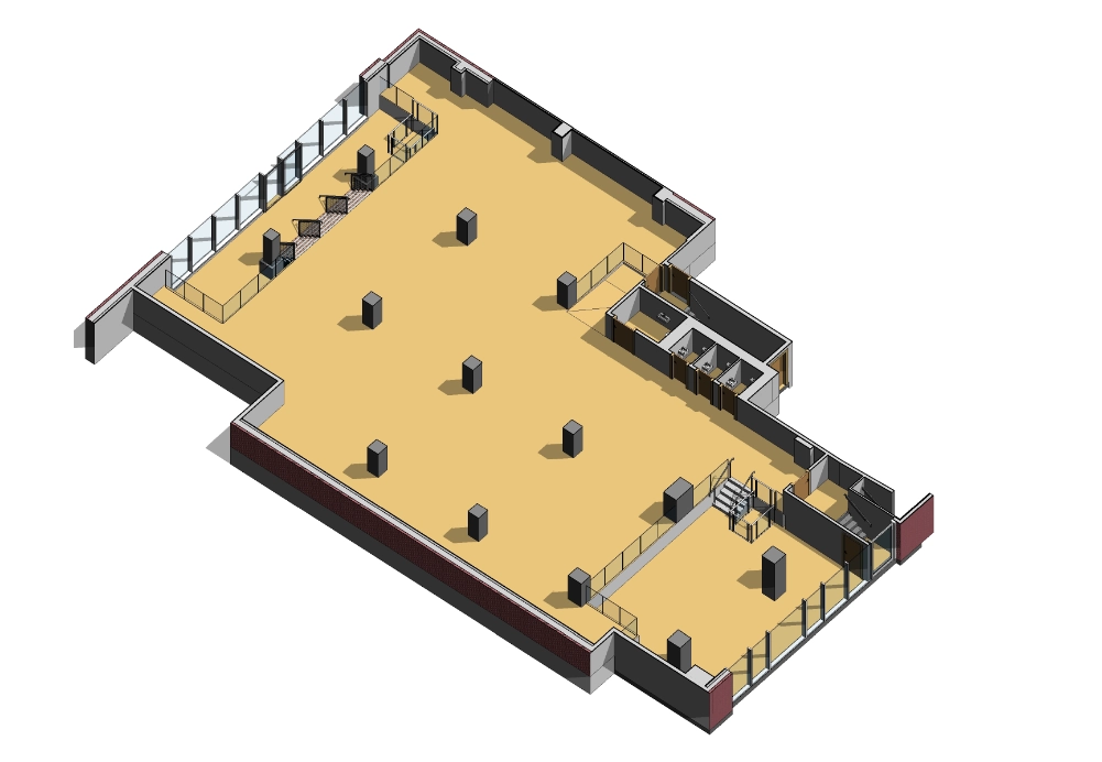
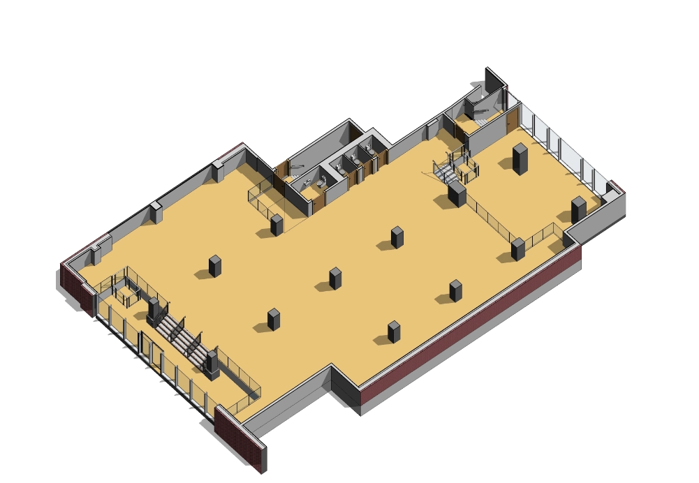
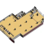
1. Measured Building Survey
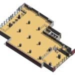
The measured survey focused on documenting all architectural and structural elements, including walls, columns, slabs, and service areas. Each component was captured to reflect existing site conditions accurately, ensuring the model provided a dependable foundation for future planning and technical evaluations.
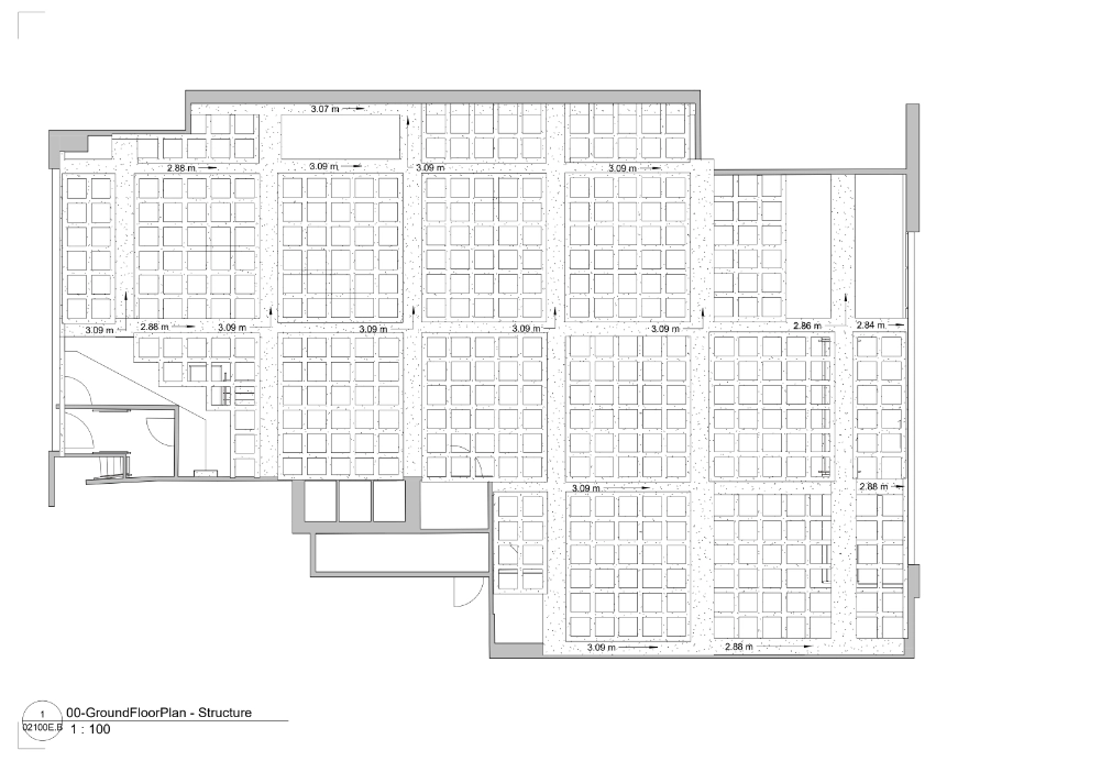
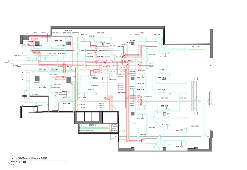
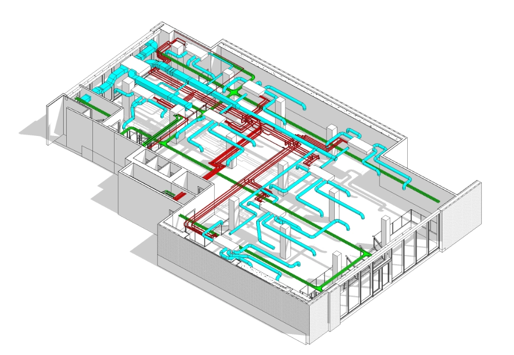
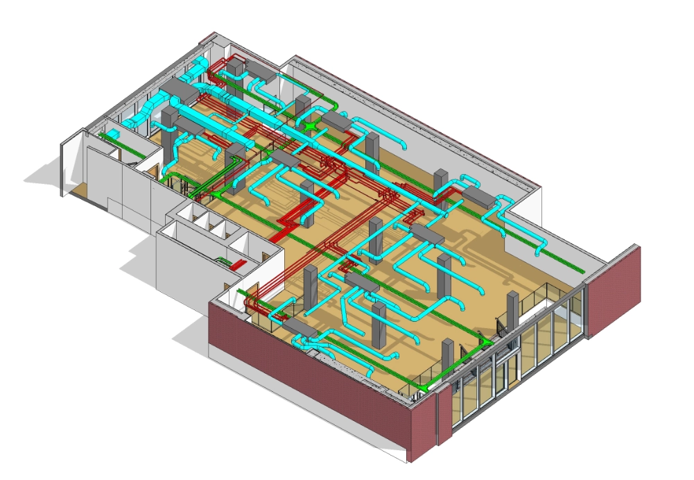
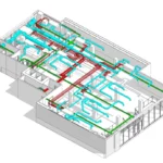
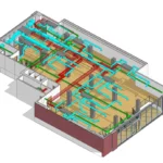
2. MEP and Ceiling Modelling
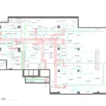
A detailed MEP and ceiling survey was carried out to map mechanical and plumbing systems with high accuracy. The modelling process included documenting coordinated routes, spatial constraints, and service zones. The distinctive waffled ceiling was modelled carefully to represent its depth, geometry, and grid pattern, ensuring all structural and service elements aligned seamlessly within the Revit environment.
Equipment Used
Laser Scanner RTC360
Leica GNSS Receiver GS14
Leica Total Station TS16
Duration
Site time: 3 days
Modelling time: 45 days
Deliverables
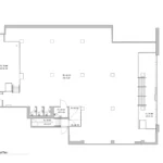
The final deliverables consisted of complete architectural, structural, and MEP floor plans, along with a detailed 3D Revit model of the ground floor. This comprehensive dataset equipped the client with reliable information for design coordination, technical analysis, and the continued development of their project documentation.