Measured Building Survey | Geo-Coordinated/Revit | Boston, UK
Project Scope
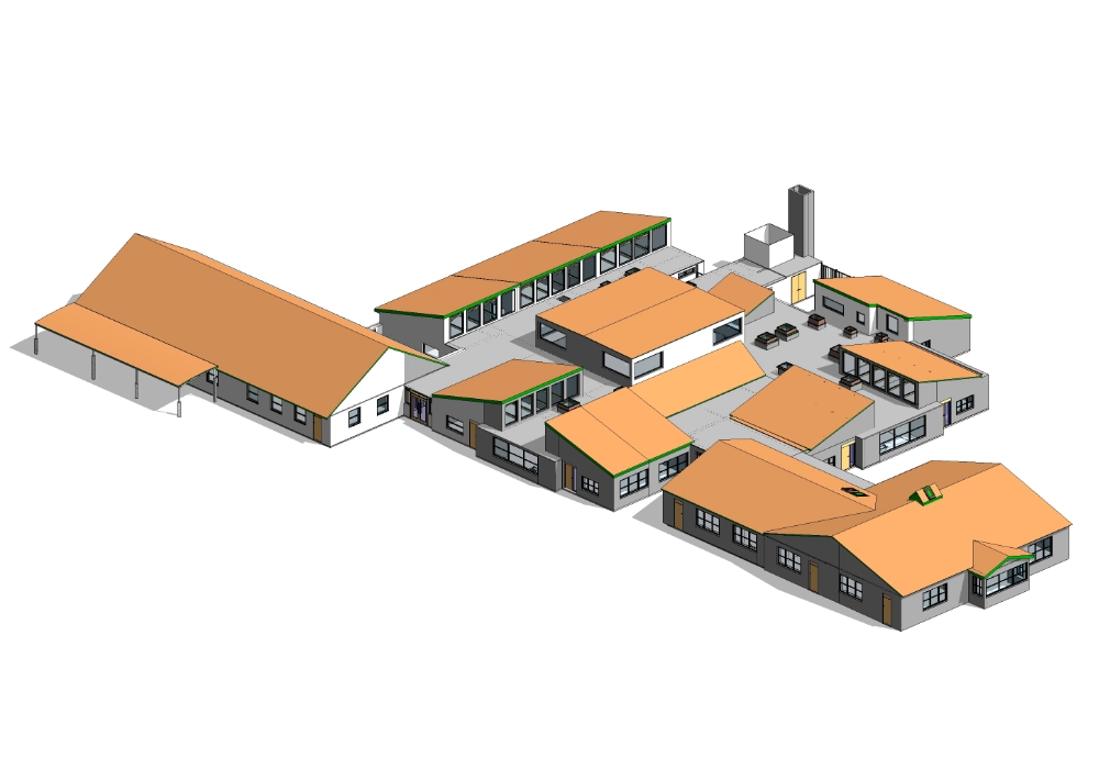
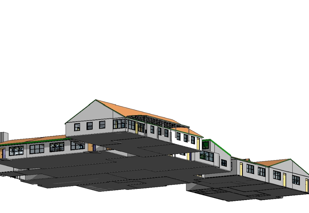
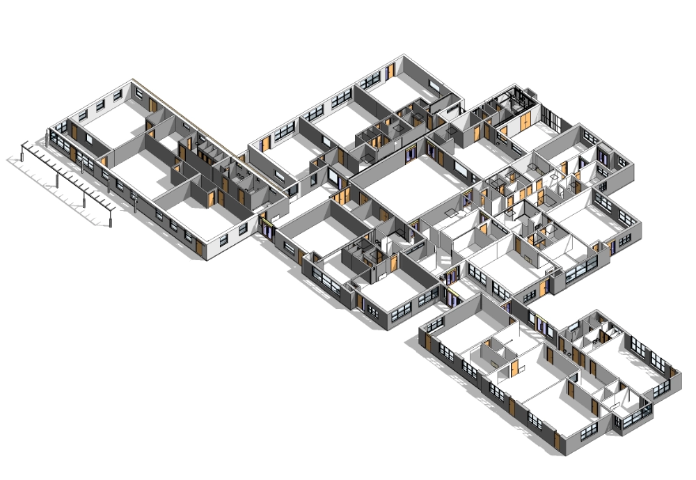
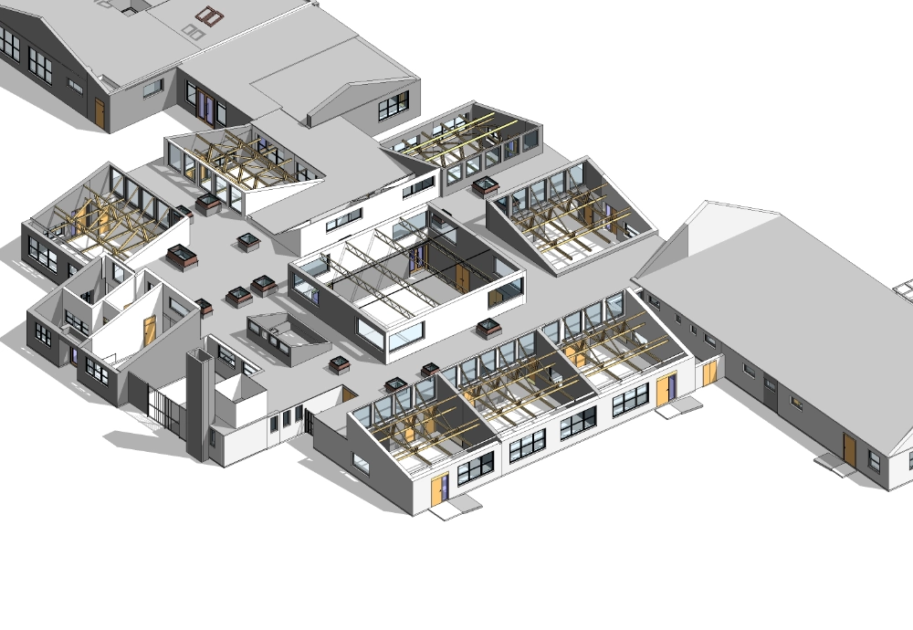
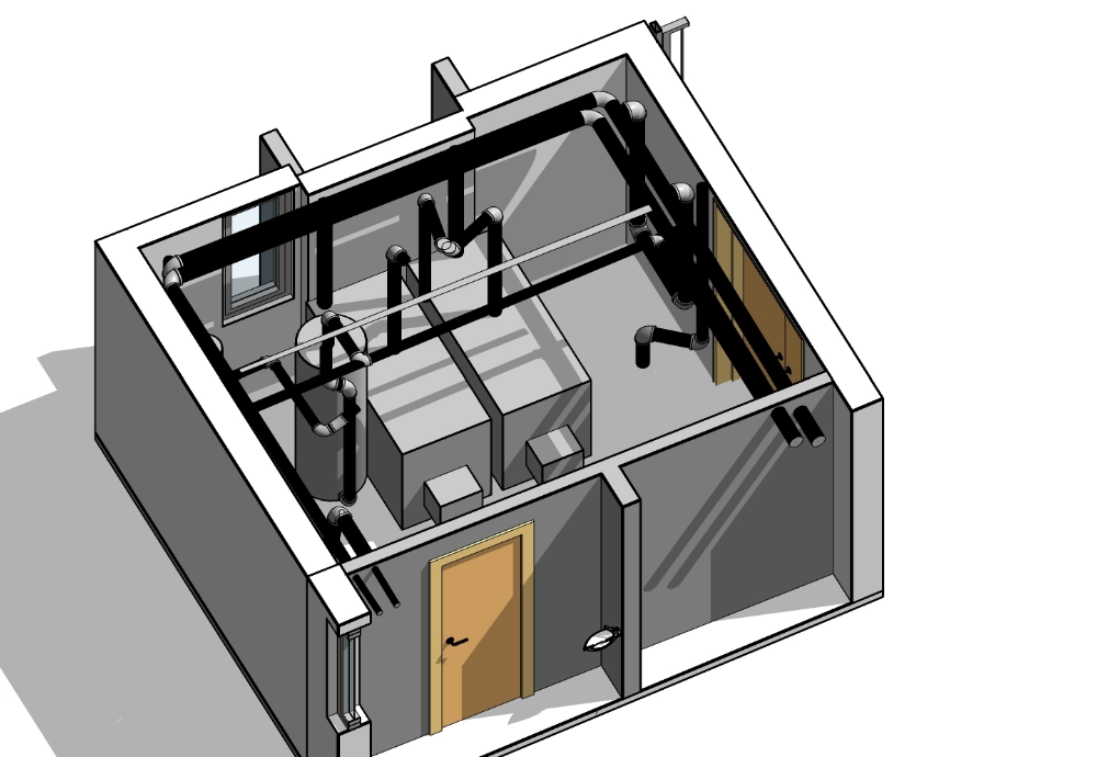
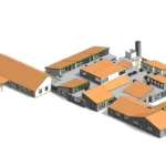
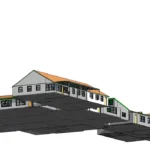
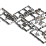
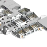
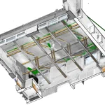
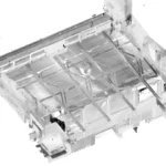
Our team carried out a Stage 4 Measured Building Survey, producing accurate 2D drawings and a detailed 3D Revit model. The survey captured architectural, structural, and key MEP elements, with a primary focus on piping systems.
Equipment Used
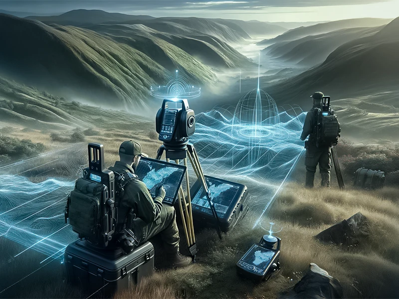
Laser Scanner RTC360
Leica GNSS Receiver GS14
Leica Total Station TS16
Duration
Site time: 3 days
Modelling time: 45 days
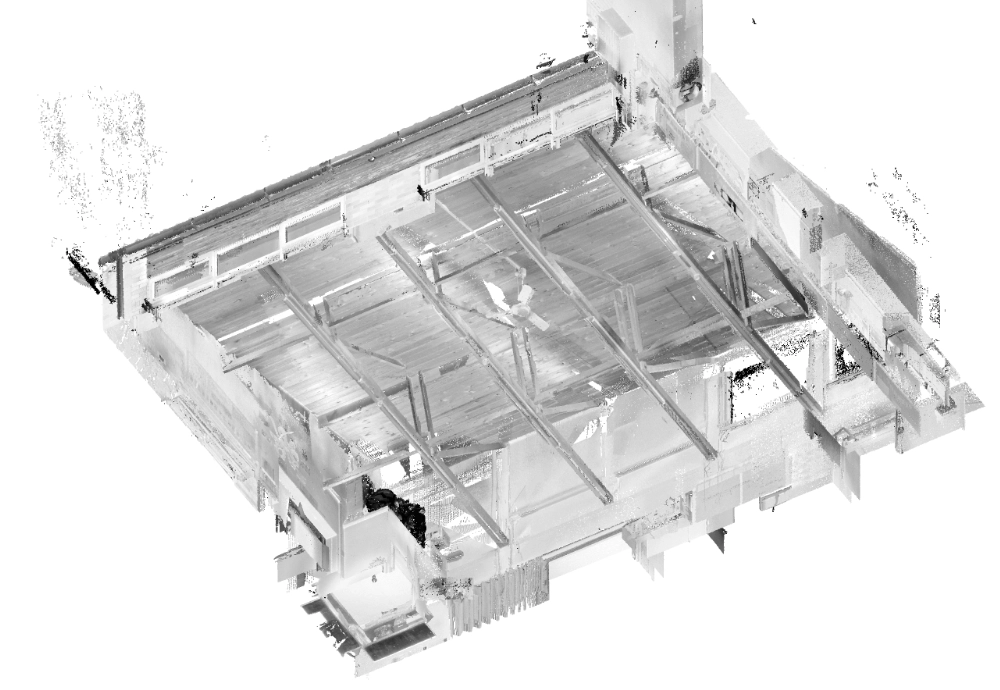
1. Measured Building Survey
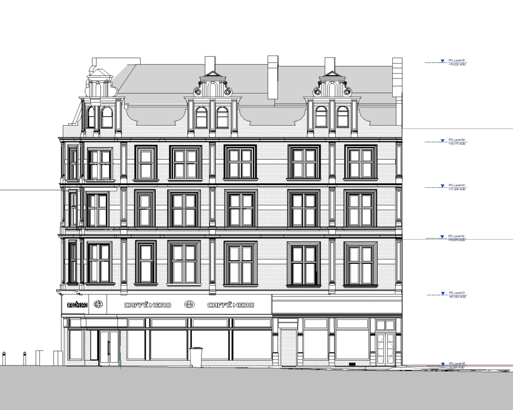
The survey was delivered in two phases. Phase 1 covered 2D floor plans and walkthrough outputs. Phase 2 involved a comprehensive 3D Revit model.
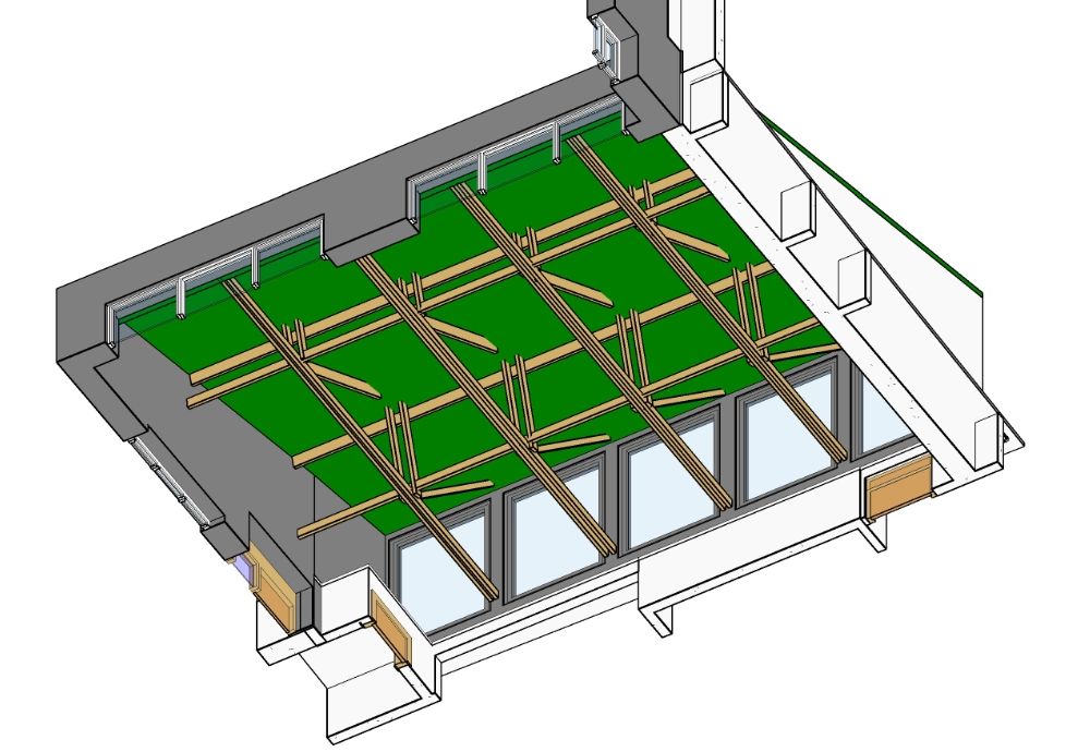
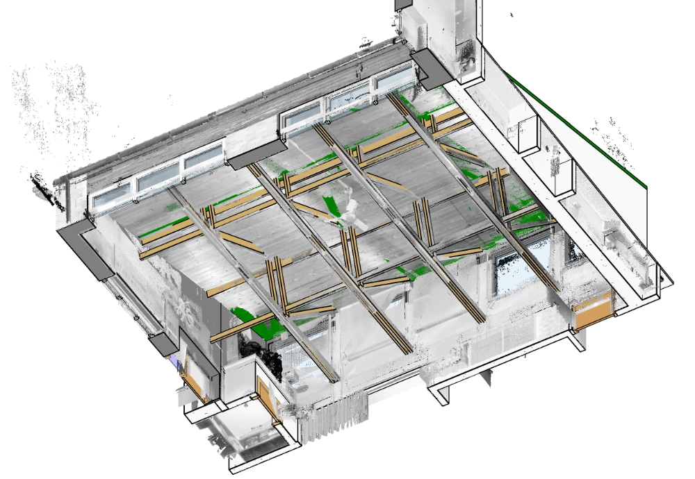
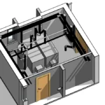
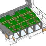
Internal elements captured include radiators, suspended ceiling voids, boiler systems, and loft spaces. Detailed roof scanning was carried out, with 360 photogrammetry used where access was restricted.
2. Modelling Requirements
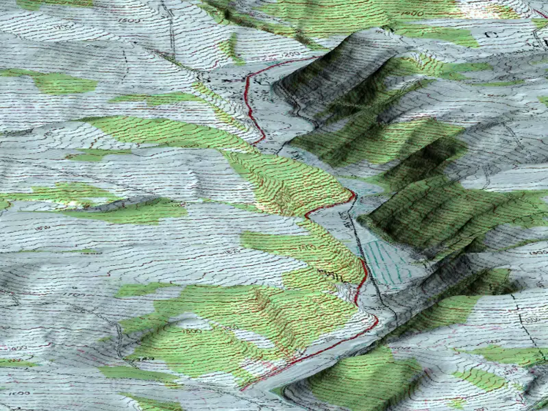
The model was geo-coordinated using an OS map with standard modelling tolerances applied. The scope covered architectural layouts, bathroom fixtures, structural elements (beams, joists, bracing, trusses), and internal features. MEP modelling focused primarily on piping systems.
Equipment Used
Laser Scanner RTC360
Leica GNSS Receiver GS14
Leica Total Station TS16
Duration
Site time: 3 days
Modelling time: 45 days
Deliverables
Deliverables were issued in two phases:
Phase 1: 2D floor plans (PDFs and DWGs)
Phase 2: 3D Revit model with coordinated floor plans