OS mapping is the default starting point for almost every site-based project. It’s fast, accessible, and good enough to sketch ideas and test massing, right up until the moment it isn’t. The problem is that the transition point from ‘good enough’ to ‘quietly misleading’ rarely announces itself. This article is about recognising that moment before it surfaces in a highways comment, a contractor query, or a threshold that simply doesn’t work.
OS Mapping Gets You Started, Then Quietly Breaks Your Scheme
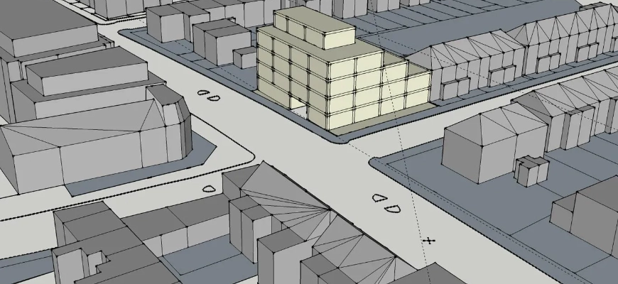
Used well, OS mapping helps you locate the site, read the surrounding street pattern and do a first pass at massing. Problems start when it becomes the design baseline. OS data is compiled for mapping, not construction. Lines may be generalised, features can shift, and levels are limited or absent. That is acceptable at feasibility, but it becomes high risk once the proposal has to physically fit the current ground and interfaces.
The Moment It Fails In Real Projects
It often shows up at the first design review. Highways point out a dropped kerb that cannot work with the actual footway levels, or a contractor flags a step at a threshold you did not allow for. The same issue appears where basements meet unexpected retaining walls, or where courtyard drainage fails because the “flat” yard actually rises and falls.
The Four Assumptions That Trigger Redesign
Assumption 1: The red line matches what’s on the ground
Assumption 2: Kerbs, channels and thresholds sit where the map suggests
Assumption 3: Adjacent building lines and levels are close enough to design to
Assumption 4: OS linework can be used as buildable design lines
Each one is a reasonable shortcut at feasibility. Each one fails regularly enough to derail coordination at detailed design stage.
The Decision You Need To Make At Concept Stage
Ask one question early: will the scheme depend on real-world levels and interfaces? If the answer is yes, for example new accesses, ramps, drainage, tight clearances or party wall conditions, move from OS to topo before options harden. It is usually quicker to redraw once from reliable data than to keep repairing a scheme based on assumptions.
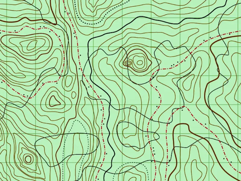
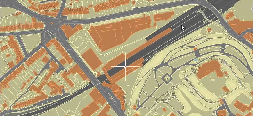
OS Mapping Is Not A Measured Site Record
OS mapping (including MasterMap) is current and useful, but it is not a site survey. It is created from aerial imagery and other sources for cartographic purposes, not for setting out construction. Ordnance Survey position it as mapping, not a substitute for an engineering survey.
What It’s Reliable For In Early Feasibility And Planning Context
In early stages, OS mapping is dependable for orientation and context. It supports locating the site and access points, understanding approximate building extents and open space, and producing massing and context studies (including early rights-of-light screening), provided drawings are clearly caveated and not presented as surveyed.
Where It Misleads Design On Tight, Level-Sensitive Sites
The risk increases on constrained sites where small differences matter. Level access design depends on true kerb and threshold levels, and crossovers and swept paths can be thrown out by relatively small positional or level errors. Courtyard falls, attenuation layouts and drainage gradients also need measured levels, and basement tie-ins are particularly vulnerable where retaining structures or neighbouring foundations are assumed rather than verified.
Why Mapped Boundaries And “Edge Of Feature” Are Not Design Lines
Mapped fences, hedges and walls are not legal boundaries, and “edge of feature” on a map may not match the boundary position on site. Walls bow, fences drift and hedges move. Designing to mapped linework can store up planning risk and party wall complications later, especially where the proposal is tight to the edge.
A Topographic Survey Is The Design Baseline For Existing Sites
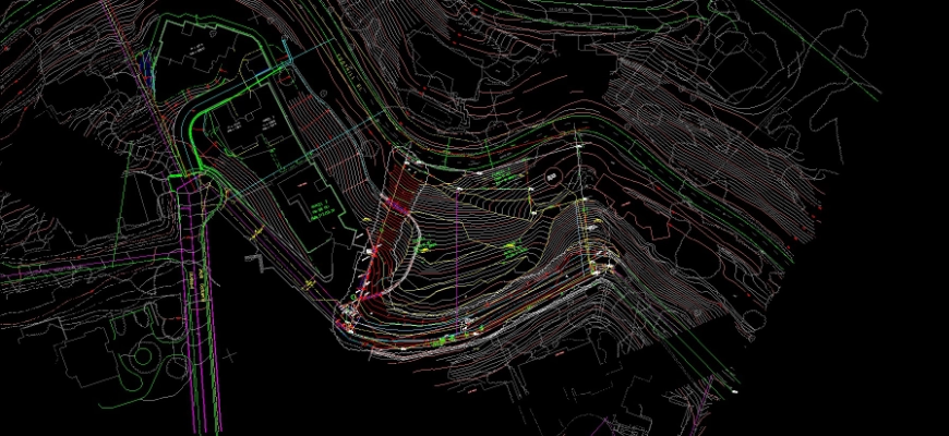
A topographic (topo) survey is a measured record of the site as it exists, with positions, levels and features captured using survey instruments. It gives the design team a coordinate-true base to set levels, falls and interfaces, and reduces the number of unknowns that tend to surface during detailed design and coordination.
What You Receive And How Architects Use It
You typically receive a CAD file (DWG/DXF) plus PDFs. A good topo will show building footprints and walls, fences, kerbs and surface breaks, along with spot levels and breaklines. It will also pick up items that affect coordination such as utility covers, street furniture, trees (stem and canopy) and visible drainage features. In practice, architects use this information to fix entrances, ramps, finished floor levels (FFLs), drainage falls, and interfaces with highways and neighbouring property.
For a quick primer, see our guide: what a topographic survey includes and why it matters: https://survey2plan.co.uk/what-is-a-topographic-survey/
Levels Are The Difference Between A Sketch And A Buildable Proposal
Without measured levels, gradients are estimates. With a topo, you can confirm whether a compliant approach to the entrance is achievable, whether a driveway clearance works under an undercroft condition, and whether falls reach an outlet without creating steps or unwanted level changes elsewhere. Those answers affect footprint, structure and cost, so they are worth resolving before the layout is treated as fixed.
Interfaces That Must Be Surveyed, Not Inferred
Certain interfaces are not safe to infer from mapping. Thresholds at main entrances and service doors, kerb, channel and back-of-footway levels for crossovers, and the position and accessible tops and toes of party and retaining walls all benefit from direct measurement. Where you are tying into adjacent buildings, overhangs and tight junctions also need to be surveyed, not guessed.
Commissioning And Checking A Topo Without Wasting Programme

A well-briefed topo can usually be turned around within a week or two, depending on site size, access and obstructions. The key is to scope what you need for the current decisions, while keeping the survey expandable if the design develops. That approach avoids over-ordering data while still removing the constraints that cause redesign.
Scope Choices That Control Time And Cost
Programme and cost are driven more by scope than by labels. Define the extent (red line plus any off-site interfaces such as across the footway to the road where required), and be clear on where level density needs to be higher, for example along an entrance route, a courtyard or a crossover. Call out details that matter to your scheme such as entrances, ramps, kerbs, drainage features, trees and structures to be retained. Confirm the coordinate system and height datum at brief stage, and set deliverables (typically DWG with sensible layers and annotation, plus PDF outputs and any notes, control and photos).
Capture Methods That Suit Complex Existing Sites
Method selection should follow the outputs and constraints. Total station work suits precise detail around buildings and streets. Laser scanning helps where façades, walls and irregular structures need dense capture for coordination. GNSS can be effective for wider open areas and tying to a national grid where conditions allow. Drone photogrammetry may suit large or inaccessible sites, subject to permissions and practical constraints. The best results often come from a mix chosen around accuracy needs, occlusions and access windows.
What “Good” Looks Like When The DWG Lands
Before you start modelling, check the DWG is usable. Layers should be clear (surfaces, kerbs, walls, trees, utilities, spot levels) and easy to isolate. Spot levels should be placed logically, with breaklines defining changes in slope. Any critical thresholds, kerb and channel levels should be called out where relevant. The coordinate system and height datum should be stated, and control points provided. Photos keyed to the plan can save time where interfaces are tight or ambiguous.
A Simple Rule-Set For Choosing OS Or Topo And Briefing It Right
The rule is straightforward: use OS to sketch and test options. Use a topo to design. The question is simply knowing which stage you’re at.
Triggers That Mean OS Is No Longer Defensible
OS should be treated as a starting point only when level dependent elements enter the design, such as ramps, crossfalls, basements or drainage gradients. The same applies where tolerances are tight, including setbacks, vehicle access geometry, headroom, rights-of-way and service areas, or where boundaries, party walls or retaining walls are sensitive. Tree constraints and RPA planning also depend on accurate positions, and many planning conditions require existing ground levels or sections that OS data cannot provide reliably.
Copy-Ready Brief Prompts For Architects And Technologists
Issue a brief that makes decisions easy for the surveyor: confirm the site address and red-line plan, specify any off-site interfaces, and state the purpose of the survey (for example highway tie-in or basement feasibility). Identify level-critical areas where you want denser levels, confirm datum and grid requirements and file formats, and flag access constraints with preferred dates and a site contact. A clear brief reduces follow-up and improves first-issue usability.
Aligning Topo With Measured Building Survey And Point Clouds
If the project needs building survey data as well, align everything from the start. Use a shared coordinate system and height datum across topo and building survey, and tie any point cloud to the topo control so façades and thresholds match. Ask for compatible layers and naming so CAD and BIM teams can federate data cleanly.
For a deeper comparison of site vs building scope, see our overview of measured building surveys and topographic surveys
If you have a live site, share the location, building type, intended works, required outputs (DWG/PDF/Revit/point cloud) and timeframe. We will advise whether OS is enough for now or quote a right-sized topo to keep the design moving.
OS Mapping Has a Place. It’s Just Not the Design Stage
OS mapping isn’t the problem. Using it past its useful point is. For orientation, context and early massing, it does exactly what it’s designed to do. The risk is treating it as a measured record of site conditions when tolerances tighten and real-world interfaces start to matter.
The cost of switching from OS to topo late is rarely just the survey fee. It’s the redesign hours, the contractor queries, the highways resubmission, and the coordination rework that follows. Commissioning a right-sized topo at the point decisions become level-dependent is almost always the cheaper path, even when it doesn’t feel like it at the time.
If you’re at the stage where the scheme is beginning to depend on what’s actually on the ground, that’s the trigger. Send us the site address, the intended works, and the interfaces that matter. We’ll scope the lightest survey that removes the assumptions your design can’t afford to carry.