Planning a rear or side extension sounds straightforward until you realise the ground levels, drainage routes, and boundary positions all need to be nailed down before a single drawing can be signed off. Get the survey wrong, or skip it entirely, and you risk redesigns, planning delays, or expensive on-site corrections that could have been avoided in week one. This guide walks you through exactly when you can reuse an existing survey, when a targeted update is enough, and when starting fresh is the only sensible move.
Start With What You Already Have
Before booking anything, gather any existing surveys, drawings and PDFs. Many small projects can move forward using previous information, but only if it can be checked and trusted.
Topographic Survey Vs Measured Building Survey
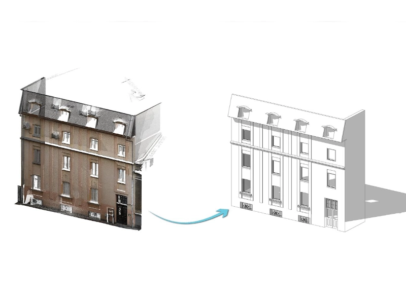
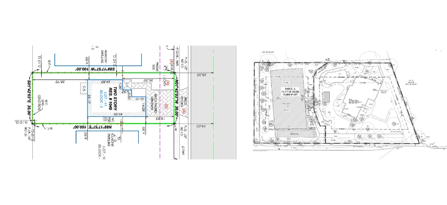
Many homeowners arrive at this stage assuming one survey covers everything. It rarely does. A topographic survey records the land around the building, including levels, surface features, boundaries, trees and drainage covers. A measured building survey records the building itself, typically floor plans, elevations and sections. For a small extension, you often need both: topo information to design thresholds, steps, falls and drainage, and measured drawings to tie the new footprint and roof back to the existing house.
If you want a quick overview of what a topo survey includes, see: What is a topographic survey?
When Reusing An Old Survey Usually Fails
Old surveys usually become unreliable when the site has changed. Common issues include regraded gardens, new patios or decking, moved fences, added sheds, or local works that affect drainage. If the survey predates a neighbour’s extension that altered boundary treatments or levels, treat it with caution. Low-quality PDFs with unclear scaling, or sketch surveys that do not state a level datum, are a common cause of errors when setting finished floor levels, steps, and external falls.
A Fast “Fit For Purpose” Check Before You Book Anything
✅ Can you confirm the survey date and what has changed on site since?
✅ Does it show spot levels around the proposed extension area and patio thresholds?
✅ Are manholes and cover levels shown clearly and labelled?
✅ Is the coordinate system and level datum stated on the drawing?
✅ Is the boundary shown, with any uncertainties noted?
If you cannot answer yes to most of these, plan for at least a targeted update.
When You Can Reuse, Update, Or Must Resurvey
Most small extensions fall into one of three routes: reuse with verification, partial update, or full resurvey. The right choice depends on how much has changed and how sensitive the design is to levels, drainage and boundaries.
Reuse With Verification
If the site has not changed materially, a short site visit to verify key levels and features can be enough. The checks typically focus on the proposed footprint area, nearby thresholds, the closest drainage covers, and boundary features that influence the design. The aim is simple: confirm the old information still matches site reality, so your designer can set finished floor levels, steps and falls with confidence.
Partial Update To Cover Gaps And Changes
If the old survey is broadly usable but misses critical detail where you are building, a partial update can be the most efficient option. This suits gardens where a small area has changed (for example, new decking affecting levels, a relocated fence, or additional drainage covers). The updated data is tied back into the original coordinate system and datum, so your team receives a single coherent plan rather than mismatched drawings.
Full Resurvey For Level, Drainage, Or Boundary-Sensitive Work
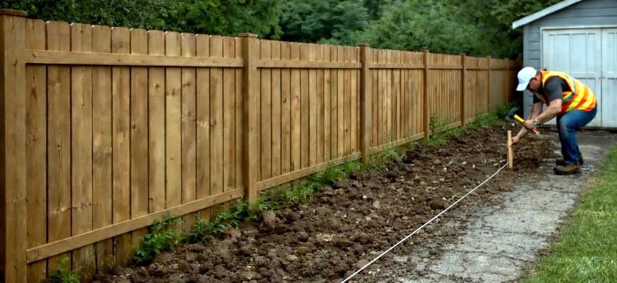
A full resurvey is usually the smartest move when the design is level-critical or close to constraints. That includes schemes aiming for flush thresholds or accessible routes, cases where drainage routes and levels are unclear (including cover levels and inverts), and extensions tight to a boundary, retaining wall or neighbouring structure. It is also the safer option when the previous survey does not state a coordinate reference or level datum. In these situations, assumptions tend to surface later as redesign or on-site changes, which usually cost more than resurveying early.
Scope That Matches A Small Extension
Small residential projects do not need an overcomplicated specification, but they do need the essentials captured clearly so the design can be set out and built.
What Your Survey Should Always Include (And Why)
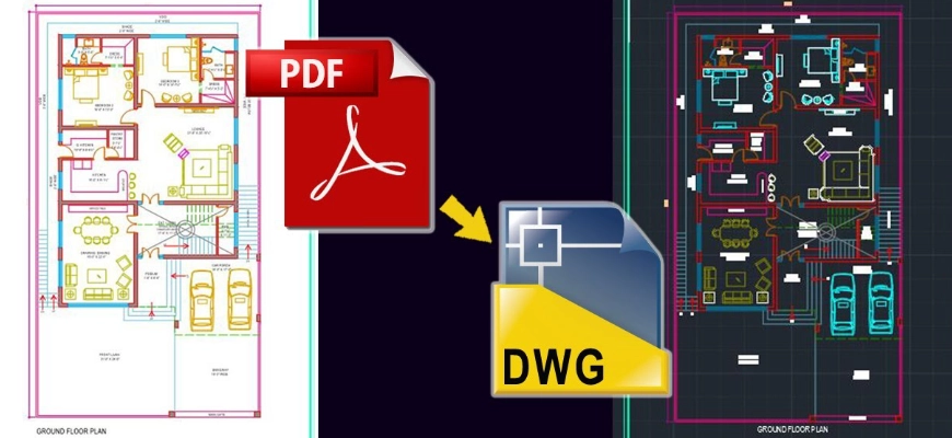
For most small extensions, the minimum deliverable is a plan at an appropriate scale (often 1:100 or 1:200) issued in PDF and DWG. It should include spot levels around the proposed footprint and key thresholds, plus the visible site features that influence layout and access, such as boundaries, walls, fences, trees, sheds, steps and patios. Drainage covers and gullies should be shown with cover levels where possible. The drawing should also state the coordinate reference and level datum. Providing DWG alongside PDF keeps coordination straightforward for most UK design teams.
Common Add-Ons That Prevent Redesign
A few targeted additions often prevent late design changes. Where safe and accessible, invert levels at key manholes near the build help avoid drainage assumptions. If the extension is close to a boundary, heights of nearby neighbouring structures can matter for massing and roof design. Recording significant trees (with basic dimensions) and noting any visible TPO reference where known helps with planning and layout decisions. Overhead lines, poles, and any surface indications of drainage runs are also worth capturing, with the reminder that this is not a full utility survey. The goal is not to over-survey, but to remove the common unknowns that trigger redesign.
What Must Be Stated On The Drawing
A usable drawing should state the survey date, site address, scale and units. It should also confirm the coordinate system and level datum used (for example, OS National Grid or a stated local datum), plus the survey limits and any areas that could not be accessed. Include notes on assumed boundaries, since a topographic survey is not a legal boundary definition, and record any known limitations. Clear notes reduce disputes later and help designer and builder work from the same assumptions. In short: a drawing that doesn’t state its own assumptions is a drawing waiting to cause an argument.
Site Realities That Affect Survey Quality
Survey accuracy depends on what can be seen and accessed on the day. A little preparation avoids gaps, revisits, and avoidable assumptions.
Access And Visibility Constraints
Dense planting, parked cars, locked side gates, or pets in the garden can block key sight lines. If the ground is hidden, levels cannot be captured properly. Clearing the build zone, moving bins and garden furniture, and arranging access to rear gardens or shared drives usually improves coverage and reduces the number of notes marked “not surveyed” on the output.
Level Control And Datum Traps
Agree the height datum early and keep it consistent. Designers may use “0.000” at internal finished floor level, while surveyors may reference Ordnance Datum or establish a local benchmark. If that link is not checked, thresholds, steps and external falls can be designed to the wrong reference. Confirm which datum will control the design and ask the survey to match it, or clearly state any transformation.
Drainage Visibility And Safe Lid Lifts
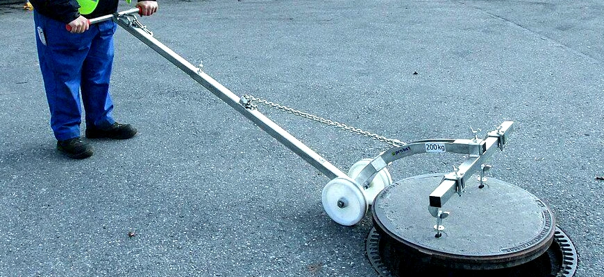
Domestic covers can often be lifted where safe, but some lids are seized, heavy, or in poor condition. For safety reasons, a dangerous lift should not be forced. Where inverts cannot be accessed safely, cover levels can still be recorded and next steps flagged. If particular manholes matter for design, identify them in advance so the survey visit can be planned around access, tools and permissions.
Cost, Programme, And Briefing
Cost and turnaround usually come down to scope clarity and access. A clear brief reduces revisions and keeps the project moving.
What Drives Cost And Lead Time
Pricing is mainly influenced by the size of the area, the detail required, and the level of drainage information needed (cover levels only, or inverts where safe). Access, parking and travel also affect time on site, as does how the survey aligns with your designer’s programme and deadlines.
For indicative ranges, see: How much topographic survey cost?
What Slows Delivery And How To Avoid It
Delays typically come from access issues and late decisions. Neighbour permissions for boundary access can take time, so secure these early. Overgrown areas hide levels, so trim back where practical. Scope drift also slows delivery, mark up the proposed footprint and confirm the must-have details, outputs and formats before the visit. Avoid last-minute datum changes, and aim to coordinate access with homeowner and designer availability to reduce the chance of multiple site visits.
Brief Template For Homeowners And Designers
Copy/paste and fill in:
- Site address and contact on the day
- Proposed works (attach a rough sketch of the extension footprint)
- What you already have (attach any previous surveys/drawings)
- Required outputs (PDF/DWG) and deadline
- Must-have details (e.g. spot levels at thresholds, inverts at MH1/MH2, neighbour wall heights)
- Preferred level datum (e.g. internal ground floor = 0.000, or OS-based)
- Access info (parking, side gate, dogs, alarms, locked areas, neighbour consent)
- Any known constraints (trees, TPOs, fragile covers, steep slopes)
If you want a quick check, send your existing survey with the notes above. We will advise whether reuse, an update, or a fresh topo is the best-value option for your extension.
Getting The Survey Right is The Cheapest Decision You’ll Make
A topographic survey for a small extension is rarely the most expensive item in the project budget. But skipping it, or reusing outdated information without checking it, frequently becomes one of the most costly decisions once redesign fees, contractor variations, and delayed sign-offs are factored in.
The core question is not whether to survey; it’s how much survey you actually need. For some projects, a short verification visit is genuinely all that’s required. For others, particularly where drainage, flush thresholds, or tight boundaries are involved, a full resurvey is the only route that removes risk from the design process.
If you’re unsure which category your project falls into, the brief template above is the fastest way to find out. Send it across with whatever existing drawings you have, and we’ll give you a straight answer on the lightest approach that still supports confident design decisions, no unnecessary scope, no surprises on site.
Ready to move forward? Contact Survey2Plan or use the brief template above to get started.